Sports
Leave the Stress Behind on King Mountain
Enjoy the cool glades of King Mountain. About 3.5 miles. No bikes on single track. Dogs welcome.
Marin is blessed with more parks and open space than any other suburban area. Every town and neighborhood in Marin has open space access, many of these open spaces were won in hard-fought battles with developers. King Mountain, behind the Larkspur downtown, is one such treasured open space.
The public lands of King Mountain Open Space Preserve actually lie in three chunks southeast of the peak. The peak of the mountain, and the trail around it, are privately owned lands with easements for preservation of the natural setting and for public access.
As with many of these small neighborhood open spaces, the access points are numerous and the location is popular with fitness and nature buffs, dogwalkers, and local residents. We recommend going to the Marin County Open Space website for a map, or using Don and Kay Martin's Hiking Marin book for more detailed directions.
Find out what's happening in San Rafaelwith free, real-time updates from Patch.
We started at the Willow Road entrance, and hiked up Citron Fire Road to the start of the loop trail. The lower portions of the open space are overrun with exotic invasive plants. Many volunteers have been working tirelessly to eradicate the scotch and french broom, thistle, and other invasive plant species. We always try to help, and this time we pulled broom that was drooping down over the trail.
As you head up the road, stay left on the fire road at junctions. Once to the King Mountain Loop Trailhead, signage is better. Every junction had a sign to keep you from wandering off the loop. A granddaddy of an oak grows at the entrance to the loop. It has clearly been hit by the ubiquitous Sudden Oak Death fungus and is fighting for life. Local residents have pulled together to try and save the tree by coating its trunk in a fungicide and removing the understory plants that may harbor the fungus. A sign at the base of the trunks asks that you do not touch the tree. The sign also states the fungicide is not toxic.
Find out what's happening in San Rafaelwith free, real-time updates from Patch.
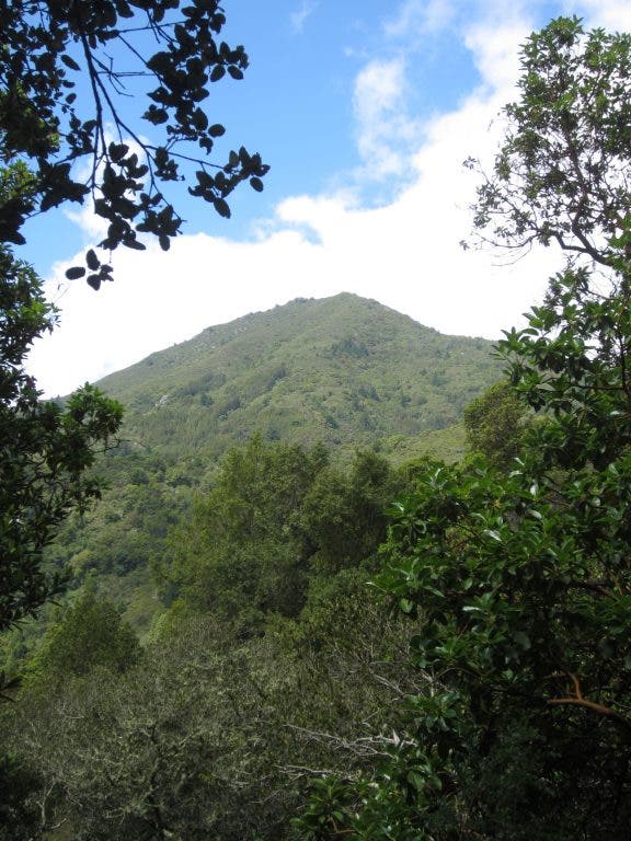
We did the loop in a clockwise fashion. The south-facing slope offers dappled shade and yellow tubular flowers of Mimulus - Sticky Monkey Flower, a heat -loving native. We also found an active beehive next to the trail in a rotted out Madrone stump. The bees were very busy and it is right next to the trail, so be careful. There are views through the trees of Blithedale Ridge and Baltimore Canyon, and tantalizing glimpses of Mt. Tam's peak towering to the north. This area is a great birdwatching region. We heard and saw many species of birds.
For an extra long hike, we recommend going out and back on Ladybug Trail to the west. Ladybug Trail goes into Baltimore Canyon and meets up with Dawn Falls Trail. Dawn Falls Trail (discussed in a earlier ) goes to the silvery Dawn Falls and beyond to Southern Marin Line Fire Road and Blithedale Ridge.
We kept it short and continued around to the north facing slopes. Here, redwoods are the dominant plant; tan oaks, ferns, and mosses create the shady understory. The air was cool and moist and full of spring time scents. The urban sounds and stressors seem miles away up in the cool glades of King Mountain.
See the book "Hiking Marin: 141 Great Hikes in Marin County" for more details. Click here to go the Marin Trails website, where you can find more information about the book.


